battle, major, Revolutionary and Napoleonic
Battle of Bautzen
Battle of Bautzen was a battle fought on 20 May 1813 at Bautzen, in what is now Germany; it lasted 1 day. It was part of the War of the Sixth Coalition, which ran from 1813 to 1814. The recorded result: French victory. Recorded strength: 100,000–200,000 against 96,000–97,000.
See it on the globe Read the article

Where it sits in the War of the Sixth Coalition
Record
| Date | 20 May 1813 to 21 May 1813 | |
|---|---|---|
| Place | Bautzen, Germany 51.183N, 14.417E | |
| Kind | Battle, Revolutionary and Napoleonic | |
| Strength | 100,000–200,000 | 96,000–97,000 |
| Casualties and losses | 20,000–25,000 | 11,000–20,000 |
| Commanders | ||


The ground today
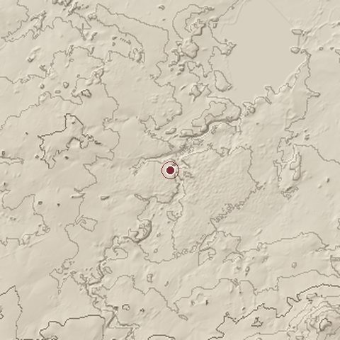
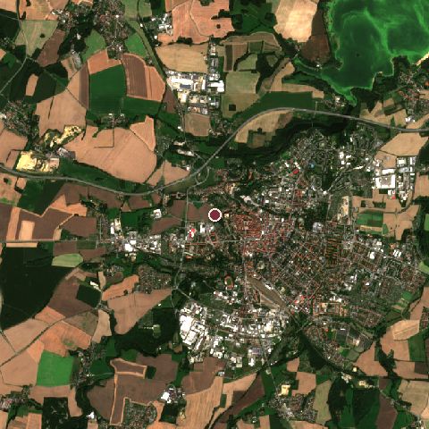
The recorded site stands at about 211 m; within 10.0 km the ground runs from 151 to 398 m, 247 m of relief, hilly country and today it is 35% cropland, 25% built-up, 22% tree cover.
Elevation from the Copernicus DEM GLO-30 (ESA, Airbus); land cover from ESA WorldCover 2021 (CC BY 4.0), within about 5 km of the recorded site. Computed, not recorded.Nearest engagements
- Siege of Bautzen 1029, same recorded site
- Siege of Bautzen 1429, 0.5 km SE
- Battle of Hochkirch 1758, 11 km E
- Battle of Horką 1431, 35 km E
- Battle of Studencem 1757, 39 km S
Contested ground: this site was fought over 3 times between 1029 and 1813.
In the same war
- Before: Battle of Halle 2 May 1813
- After: Battle of Reichenbach 1813
- All 73 engagements of War of the Sixth Coalition
Elsewhere in 1813
- Battle of Vitoria Spain
- Battle of the Thames Canada
- Battle of Lake Erie Canada
- Battle of Mecca Saudi Arabia
- Battle of San Lorenzo Argentina
Combat data (CDB90)
| Attacker: FR ARMY | Defender: PR & RUSS ARMIES | |
| Strength | 199,000 | 97,000 |
| Casualties | 25,000 (12.6%) | 20,000 (20.6%) |
| Mission accomplishment, 1 to 10 | 6 | 4 |
| Outcome | attacker won | |
| Duration | 1.6 days | |
| Front width | 9.6 km | 11.2 km |
| Attacker advanced | 10 km | |
From the US Army Concepts Analysis Agency Database of Battles (CDB90, battle 136), public domain, in the CC0 tidy edition by Jeffrey B. Arnold. Figures are the database's estimates, compiled in 1990 from published histories, and may differ from the Wikipedia infobox above.
Battle of Bautzen is one of 3,694 engagements of the 19th century in the atlas and one of 668 in present-day Germany.
Sources
Identity, coordinates, dates and the war from Wikidata Q170265, released under CC0. Result, belligerents, commanders, strength and casualties from the infobox of the English Wikipedia article Battle of Bautzen (1813), revision 1379028785, read 2026-11-14, licensed CC BY-SA 4.0; the article's text is not reproduced here. Present-day country and state from Natural Earth. Dates before 1582 follow the Julian calendar as recorded.