siege, major, medieval
Battle of Nancy
Battle of Nancy was a siege conducted on 22 October 1476 at Nancy, in what is now France; it lasted 2 months. It was part of the Burgundian Wars, which ran from 1474 to 1477. The recorded result: Lorraine-Swiss victory; Death of Charles the Bold; End of the Burgundian Wars; Dissolution of the Burgundian State. Recorded strength: 2,000–8,000 men against Lorraine: 10,000–12,000 men.
See it on the globe Read the article

Where it sits in the Burgundian Wars
Record
| Date | 22 October 1476 to 5 January 1477 | |
|---|---|---|
| Place | Nancy, France 48.695N, 6.181E | |
| Kind | Siege, medieval | |
| Strength | 2,000–8,000 men | Lorraine: 10,000–12,000 men |
| Casualties and losses | Unknown, presumably near total | Unknown |
| Commanders |
| |

The ground today
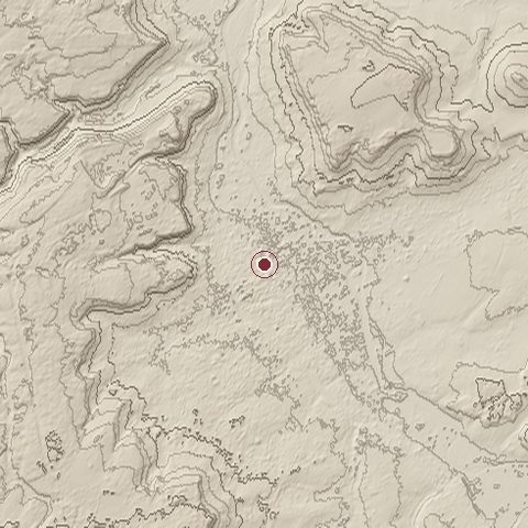
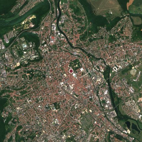
The recorded site stands at about 210 m; within 10.0 km the ground runs from 182 to 404 m, 221 m of relief, hilly country and today it is 59% built-up, 32% tree cover, 6% grassland.
Elevation from the Copernicus DEM GLO-30 (ESA, Airbus); land cover from ESA WorldCover 2021 (CC BY 4.0), within about 5 km of the recorded site. Computed, not recorded.Nearest engagements
- Battle of Nancy 1944, 0.3 km SE
- Battle of Grand Couronné 1914, 13 km NE
- Siege of Toul 1870, 21 km W
- Battle of Flirey 1914, 32 km NW
- Battle of Arracourt 1944, 32 km E
In the same war
- Before: Battle of Morat 22 June 1476
- All 7 engagements of Burgundian Wars
Elsewhere in 1476
- Battle of Valea Albă Romania
- Battle of Toro Spain
- Siege of Neamţ Citadel Romania
- Battle of Gibraltar Gibraltar
- Siege of Fuenterrabía Spain
Battle of Nancy is one of 743 engagements of the 15th century in the atlas and one of 1,495 in present-day France.
Sources
Identity, coordinates, dates and the war from Wikidata Q316877, released under CC0. Result, belligerents, commanders, strength and casualties from the infobox of the English Wikipedia article Battle of Nancy, revision 1383077303, read 2026-11-14, licensed CC BY-SA 4.0; the article's text is not reproduced here. Present-day country and state from Natural Earth. Dates before 1582 follow the Julian calendar as recorded.