battle, major, interwar and Second World War
Battle of Maysalun
Battle of Maysalun was a battle fought on 24 July 1920 at Maysalun, in what is now Syria. It was part of the Franco-Syrian War. The recorded result: French victory. Recorded strength: 12,000 troops; (backed by tanks and aircraft) against 1,400–4,000 regulars; Bedouin cavalrymen; civilian volunteers.
See it on the globe Read the article

Where it sits in the Franco-Syrian War
Record
| Date | 24 July 1920 | |
|---|---|---|
| Place | Maysalun, Syria 33.596N, 36.065E | |
| Kind | Battle, interwar and Second World War | |
| Strength | 12,000 troops; (backed by tanks and aircraft) | 1,400–4,000 regulars; Bedouin cavalrymen; civilian volunteers |
| Casualties and losses | 42 killed; 152 wounded; 14 missing; (French claim) | ~150 killed; ~1,500 wounded; (French claim) |
| Commanders |
|
|

The ground today
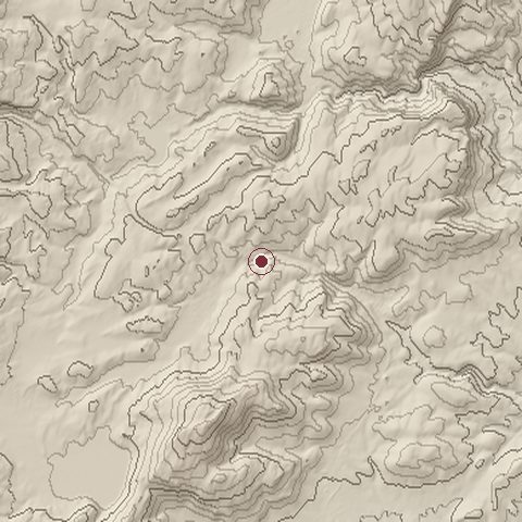
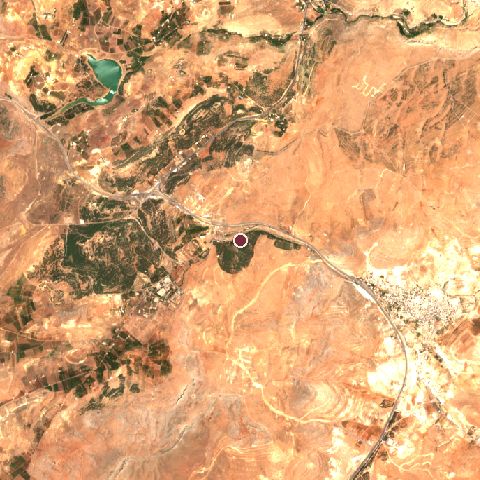
The recorded site stands at about 1,148 m; within 10.0 km the ground runs from 916 to 1,632 m, 716 m of relief, steep country and today it is 68% grassland, 15% tree cover, 8% shrubland.
Elevation from the Copernicus DEM GLO-30 (ESA, Airbus); land cover from ESA WorldCover 2021 (CC BY 4.0), within about 5 km of the recorded site. Computed, not recorded.Nearest engagements
- Battle of Anjar 1623, 19 km NW
- Battle of Sultan Yacoub 1982, 20 km W
- 1973 al-Mazzah Airport Raid 1973, 20 km SE
- Siege of Damascus AD 634, 23 km SE
- Siege of Damascus 1078, 23 km SE
In the same war
- Before: Battle of Tel Hai 1920
- After: Capture of Damascus 1920
- All 3 engagements of Franco-Syrian War
Elsewhere in 1920
- Battle of Warsaw Poland
- Red Army invasion of Azerbaijan Azerbaijan
- Kyiv offensive Ukraine
- Red Army invasion of Armenia Armenia
- Battle of the Niemen River Belarus
Battle of Maysalun is one of 4,429 engagements of the 20th century in the atlas and one of 139 in present-day Syria.
Sources
Identity, coordinates, dates and the war from Wikidata Q994316, released under CC0. Result, belligerents, commanders, strength and casualties from the infobox of the English Wikipedia article Battle of Maysalun, revision 1370449372, read 2026-11-14, licensed CC BY-SA 4.0; the article's text is not reproduced here. Present-day country and state from Natural Earth. Dates before 1582 follow the Julian calendar as recorded.