battle, major, medieval
Battle of Benevento
Battle of Benevento was a battle fought on 26 February 1266 at Benevento, in what is now Italy. It was part of the Crusade against the Hohenstaufen, which ran from 1240 to 1268. The recorded result: Decisive Guelph victory.
See it on the globe Read the article

Where it sits in the Crusade against the Hohenstaufen
Record
| Date | 26 February 1266 | |
|---|---|---|
| Place | Benevento, Italy 41.134N, 14.773E | |
| Kind | Battle, medieval | |
| Strength | 12,000 men; 600 knights; 2,400 men-at-arms and mounted sergeants; 600 crossbowmen; 8,400 infantry | 13,500–14,000 men; 1,200 German mercenary knights and men-at-arms; 1,000–1,400 Italo-Norman knights and men-at-arms; 1,000 Italian mercenary horsemen; 300–400 Saracen light cavalry; 10,000 Saracen archers |
| Casualties and losses | Unknown but comparatively light | Most of the army; Only 600 of the 3,600 armoured cavalrymen escaped death or capture; Annihilation of the Saracen corps |
| Commanders |
|
|
The ground today
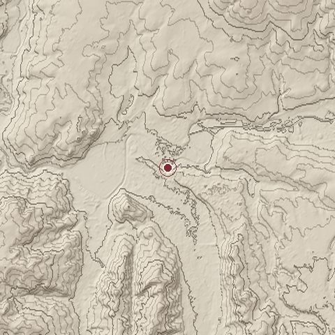
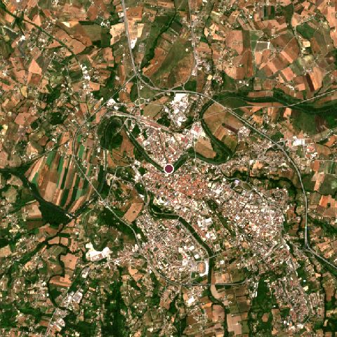
The recorded site stands at about 116 m; within 10.0 km the ground runs from 85 to 375 m, 290 m of relief, hilly country and today it is 35% tree cover, 31% cropland, 26% built-up.
Elevation from the Copernicus DEM GLO-30 (ESA, Airbus); land cover from ESA WorldCover 2021 (CC BY 4.0), within about 5 km of the recorded site. Computed, not recorded.Nearest engagements
- Second Battle of Beneventum 212 BC, 0.5 km SE
- Battle of Beneventum 214 BC, 0.8 km E
- Battle of Beneventum 212 BC, 0.8 km E
- Battle of Beneventum 275 BC, 0.8 km E
- Battle of Ager Falernus 217 BC, 19 km W
Contested ground: this site was fought over 5 times between 275 BC and 1266.
In the same war
- Before: Siege of Aachen 1248
- After: Battle of Tagliacozzo 23 August 1268
- All 4 engagements of Crusade against the Hohenstaufen
Elsewhere in 1266
- Battle of Mari Turkey
- Siege of Kenilworth United Kingdom
- Battle of Trapani Italy
- Siege of Safed Israel
- Battle of Chesterfield United Kingdom
Battle of Benevento is one of 629 engagements of the 13th century in the atlas and one of 1,038 in present-day Italy.
Sources
Identity, coordinates, dates and the war from Wikidata Q283062, released under CC0. Result, belligerents, commanders, strength and casualties from the infobox of the English Wikipedia article Battle of Benevento, revision 1382319910, read 2026-11-14, licensed CC BY-SA 4.0; the article's text is not reproduced here. Present-day country and state from Natural Earth. Dates before 1582 follow the Julian calendar as recorded.